Stage n. 64
Staiti – Palizzi
Area
Aspromonte Meridionale – Area Greca
Difficulty
E – Also accessible via MTB
Distance
14 km
Travel time
6 – 9 hrs
Start
Staiti
Finish
Palizzi
Difference in altitude
↑ 700m ↓1000m
Accessible
All year round
River/fiumare crossing (waypoint)
Fonte di Pietrapennata
River/fiumare crossing (waypoint)
No
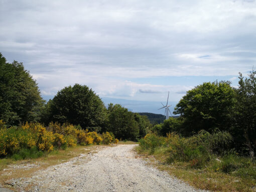
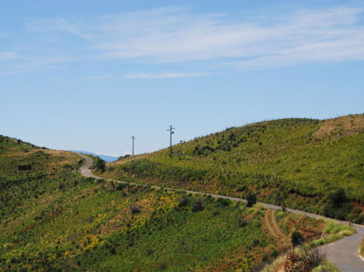
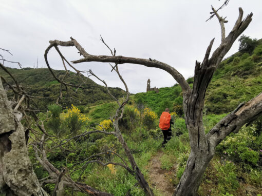
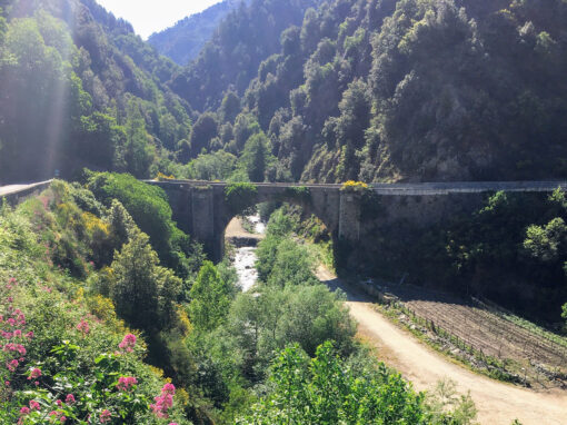
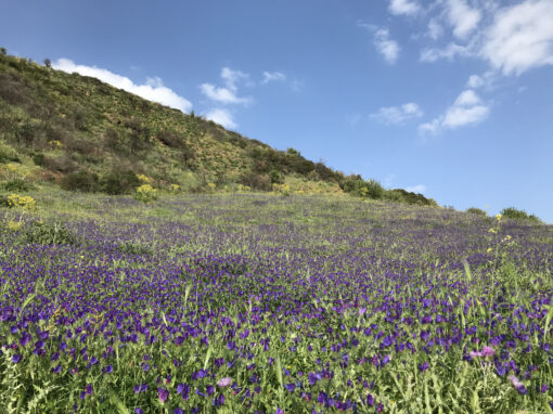
Spectacular panoramic views onto the Valle degli Armeni, the Locride and the ridges and peaks of the Eastern Aspromonte Massif, that gently wanes towards the sea. The trail retraces the first stage of the “Sentiero dell’Inglese” (Way of the Englishman), named in memory of the English traveller and illustrator Edward Lear, that hiked here in the second half of the 19th century, illustrating his stories and lithographies in the book “Diario di un viaggio a piedi” (Journal of a Landscape Painter in Southern Calabria). The remains of the walls and tower bell of the Chiesa delle Madonna dell’Alica are particularly moving: the ruins date back to the XII century and were probably part of a larger religious complex of Byzantine origins.

The trail near the ruins of Chiesa Madonna dell’Alica
Spectacular panoramic views onto the Valle degli Armeni, the Locride and the ridges and peaks of the Eastern Aspromonte Massif, that gently wanes towards the sea. The trail retraces the first stage of the “Sentiero dell’Inglese” (Way of the Englishman), named in memory of the English traveller and illustrator Edward Lear, that hiked here in the second half of the 19th century, illustrating his stories and lithographies in the book “Diario di un viaggio a piedi” (Journal of a Landscape Painter in Southern Calabria). The remains of the walls and tower bell of the Chiesa delle Madonna dell’Alica are particularly moving: the ruins date back to the XII century and were probably part of a larger religious complex of Byzantine origins.
The trail near the ruins of Chiesa Madonna dell’Alica
Zona
Aspromonte Meridionale – Area Greca
Difficoltà
E Percorribile anche in MTB
Distanza
14 km
Tempo di percorrenza
6-9 ore
Partenza
Staiti
Arrivo
Palizzi
Dislivello
↑ 700m ↓1000m
Percorribile
Tutto l’anno
Fonti e sorgenti con waypoint
Fonte di Pietrapennata
Attraversamenti fiumi e fiumare (waypoint)
No

Ruderi Chiesa Madonna dell’Alica
Route
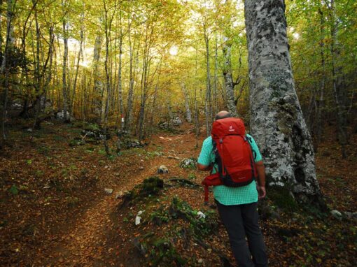
Part of the trail runs within the Parco Nazionale dell’Aspromonte and retraces the first stage of the “Sentiero dell’Inglese” (Way of the Englishman), named in memory of the English traveller and illustrator Edward Lear, that hiked here in the second half of the 19th century illustrating his stories and lithographies in the book “Diario di un viaggio a piedi” (Journal of a Landscape Painter in Southern Calabria). From the city centre of Staiti, the trail follows the white/red signage of the Sentiero dell’Inglese, along a panoramic road gradually going uphill until it turns into a gravel road. Spectacular panoramic views onto the Valle degli Armeni, the Locride and the ridges and peaks of the Eastern Aspromonte Massif, that gently wanes towards the sea. The trail continues across a mixed forest of oak tree and then, at a young pine forest, leaves the gravel road (that takes to Campi di Bova) and proceeds left on a second path unravelling across a dense vegetation of maquis shrubland and bushes of cistus, ferns and brooms.
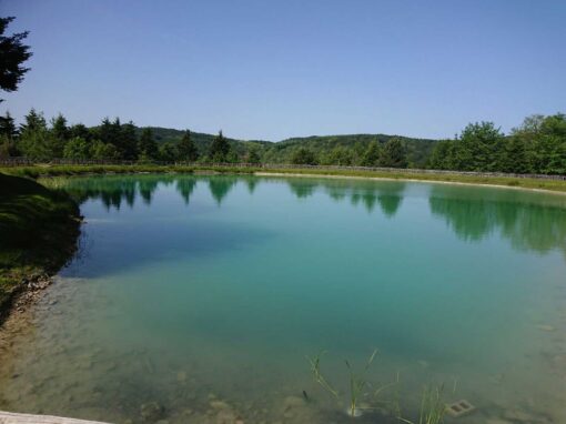
The trail continues to offer visitors incredible panoramic views, perfumes, and picturesque landscapes until the ruins of what seems to be a old monastic settlement. The Chiesa della Madonna dell’Alica (dating back to the XII century and, according to historians, probably part of a larger religious complex of Byzantine origins) towers over a system of dry stone wall terraces and old buttresses. Leaving the church behind, the trail goes on a gentle climb until it intersects a gravel road looking onto the steep valleys of Bova, whose cliff towers over the peaks of Aspromonte and the intense colours of the surrounding vegetation. The gravel road goes uphill until the graveyard of Pietrapennata and a paved road. From here hikers will continue to the hamlet of Pietrapennata and then Palizzi.
Brief historical overview
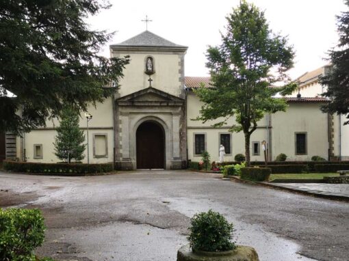
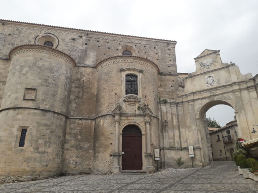
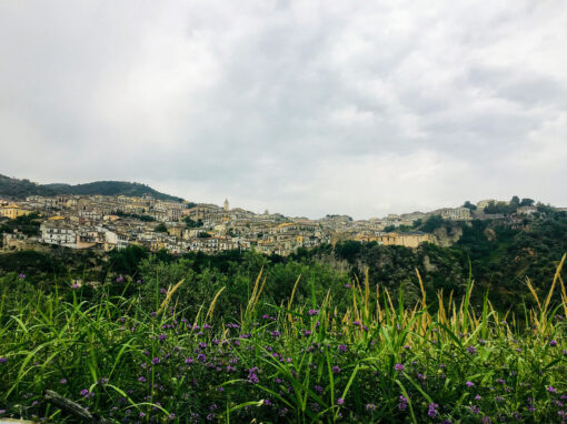
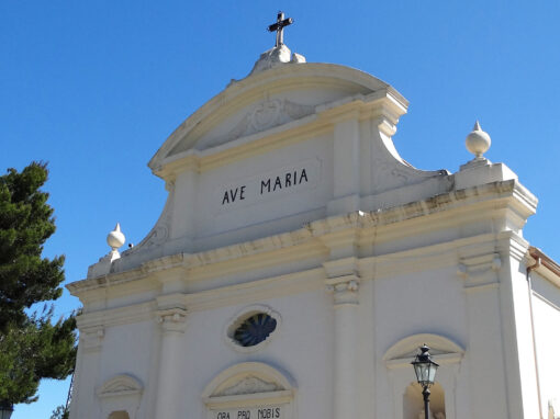
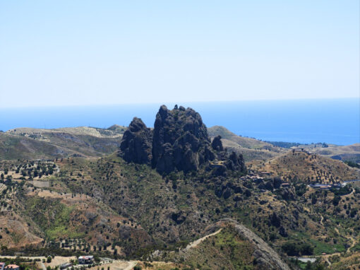
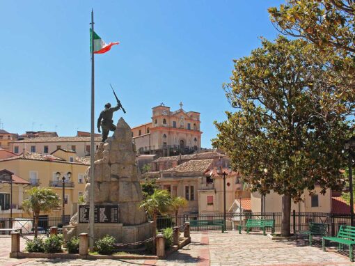
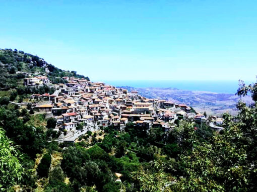
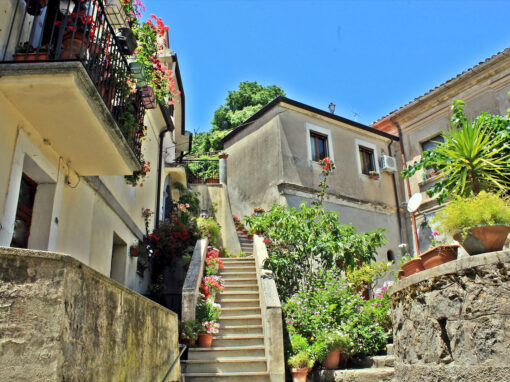
The village of Staiti is perched along the ridge of Mount Giambatore (450m above sea level), in the Parco Nazionale dell’Aspromonte. It overlooks the Valley of Fiumara Bruzzano, also known as the Valle degli Armeni (Valley of the Armenians) due to the presence of many remains left behind by Armenian populations arrived in Calabria during the 5th century. Probably founded as a small village of shepherds and farmers, Staiti has a classical Medieval structure made of small houses (arranged following to the natural shape of the terrain), with narrow alleys, steps, arches and apotropaic masks. The Chiesa di Santa Maria della Vittoria, in the city centre, was built during the first half of the 17th century to commemorate the victory of Lepanto against the Turks (1571). The church features a beautiful statue of the Virgin with Child (1622) and two baroque altars. One of the most important monuments of Byzantine/Norman era is located on the road that connects the Marina of Staiti with the quarter of Badia: the Church of Santa Maria dei Tridetti, dating back to the XI-XII century.

View onto the village of Staiti
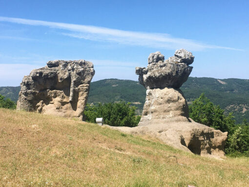
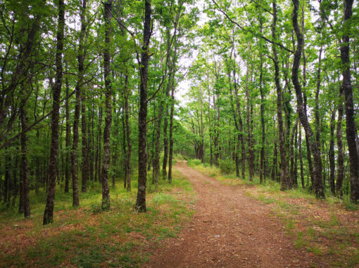
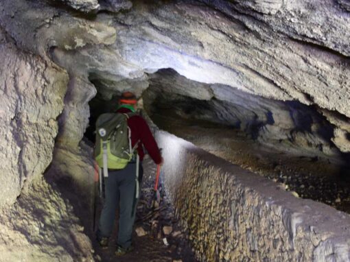
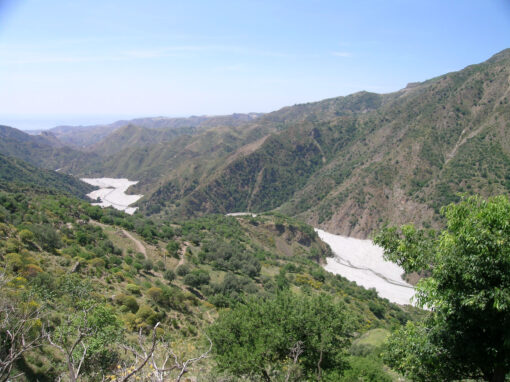
The small hamlet of Pietrapennata, today a district of Palizzi, is located between the latter and the village of Staiti. English traveller Edward Lear in the second half of the 19th century described Pietrapennata in his “Diario di un viaggio a piedi” (Journal of a Landscape Painter in Southern Calabria): “…Pietrapennata is rather unremarkable, but then all of a sudden, from above it, a most beautiful landscape opened up in front of our eyes. What incredible and isolated cliffs! What wide and dense forest! What faint and graceful lines over the horizon, between the blue sea and the long plains of Eastern Italy! …Oh, precious forests of Pietrapennata! I do not recall a most beautiful place…wherever we will head to next, it will be very difficult to find another Pietrapennata…”.

Staiti borgo
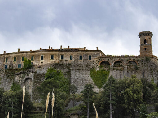
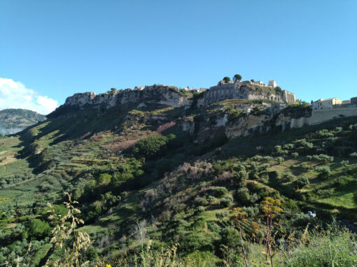
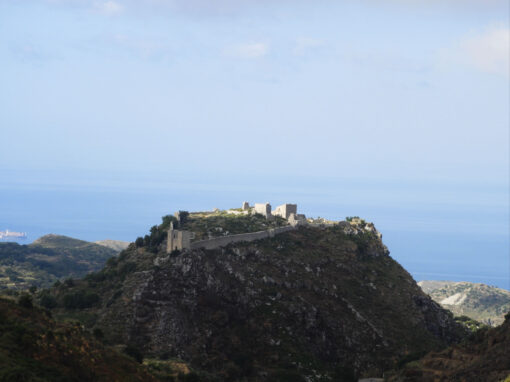
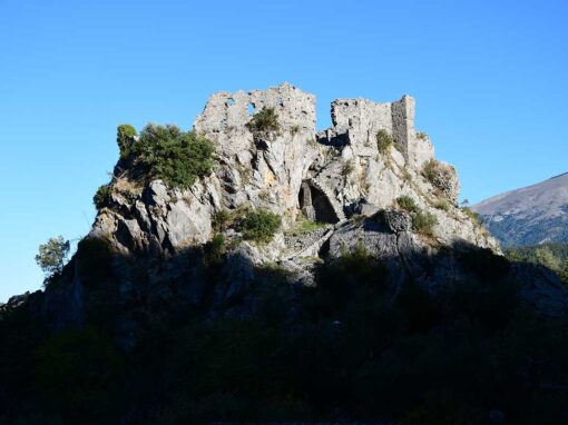
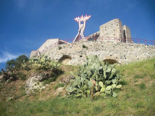
The village of Palizzi is at the bottom of a sandstone rocky spur with the ruins of a feudal castle towering above it. Even though archaeological finds attest that the area has been inhabited since prehistoric times, the first written records mentioning the village only date back to the XI century. The hamlet was first property of the Monastero di Sant’Angelo of the Valle del Tuccio, and then included as one of the hamlets of Bova in the XII century. It turned into an important feud at the beginning of the 14th century and was bought around the first half by the Ruffo family, one of the most important noble families of Southern Italy. Palizzi Marina is on the coast. An excellent red wine with IGT label is produced locally, and we recommend drinking it in one of the characteristic “catoi” of the village – that make Palizzi the “city of wine”.
Located on the road that connects the marina to Staiti, in the Badia district, there is one of the most important monuments of the Byzantine-Norman age: the church of Santa Maria dei Tridetti dating back to the 11th-12th century.

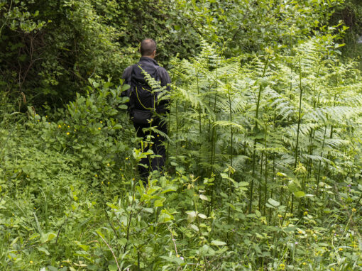
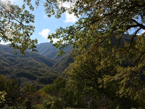
Near the hamlet of Pietrapennata
Map and elevation profile
Further information
Guide of reference for the stage: Andrea Laurenzano Coop. San Leo +39 347 3046799, Mario Giuseppe Petrulli +39 340 7224018, Giuseppe Battaglia +39 339 4021274, Noemi Evoli +39 388 8610184, Antonio Frangipani +39 340 2458208
[Palizzi]
Comune Palizzi – tel. +39 0965 763621 – web: www.comune.palizzi.rc.it
Where to sleep
[Staiti]
Scattered hotels – Al Borgo di Pietrapennata – Via Stretto, 3 Pietrapennata – Palizzi – tel. +39 328 6849329 – mail: alborgodipietrapennata@pec.it
Scattered hotels – Roberto Pangallo – Staiti – tel. +39 380 5973290 – mail: annapangallo@tiscali.it
Extra: not verified
[Palizzi]
Scattered hotels – Coop. U Schicciu – tel. +39 338 9196349 – mail: emanuelemaisano@gmail.com
Where to eat
[Staiti]
Restaurant – La taverna dei Santi – Vico Piazza Vittoria – tel. +39 388 929914 – moroalba@gmail.com
Scattered hotels – Al Borgo di Pietrapennata – Via Stretto, 3 Pietrapennata – Palizzi – tel. +39 328 6849329 – mail: alborgodipietrapennata@pec.it
With thanks to Regione Calabria for the Contribution to the project.
Last update: 2024-05-07
Continue your journey on the trail


Contact us
Why are we asking you to solve this? To make sure you are human and to avoid being swamped with spam. Thanks for helping us!
Project realised with the contribution of Regione Calabria
Project realised with the contribution of Regione Calabria